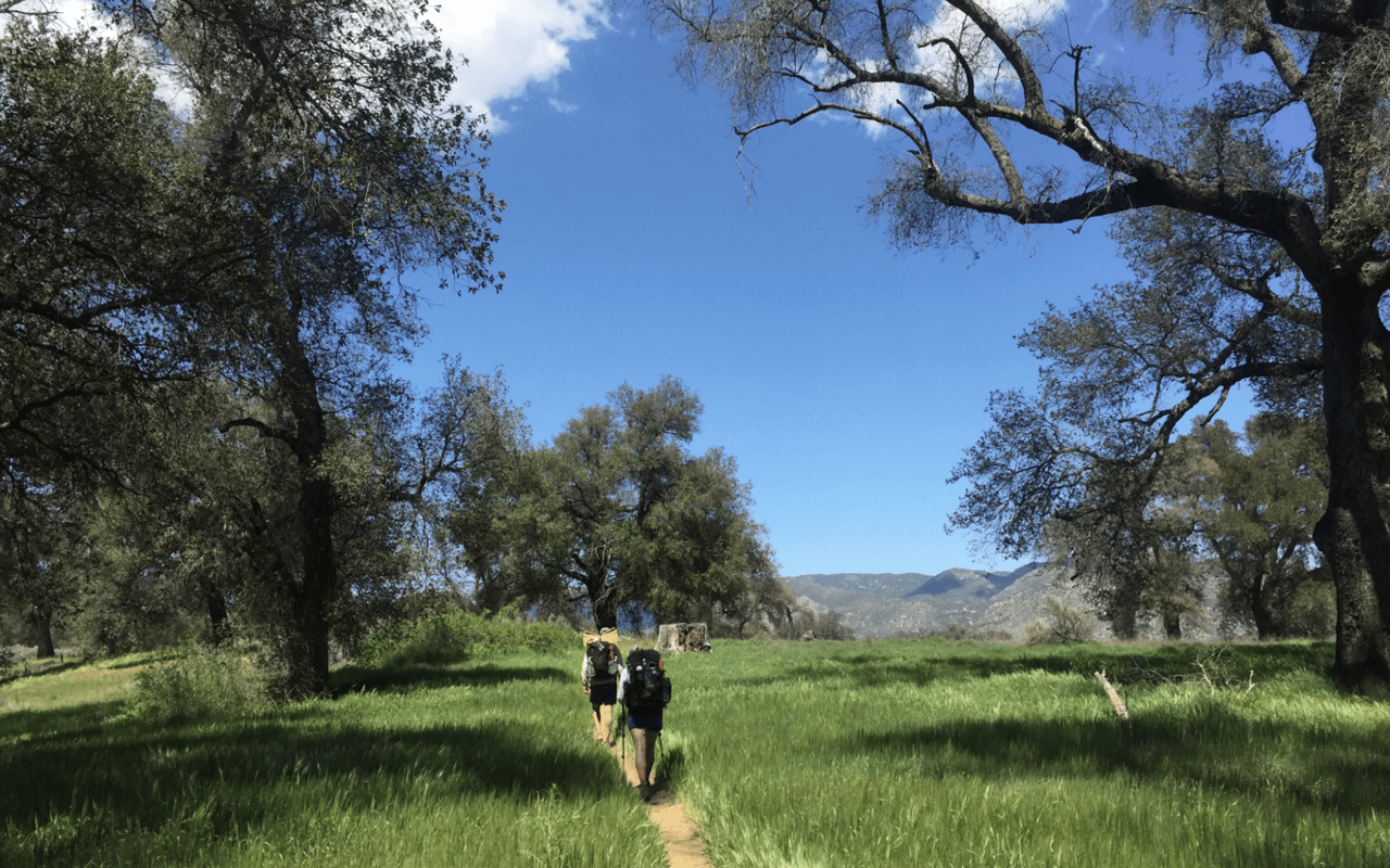
Not all hiking trails are created equal. Some are perfect for a relaxed morning stroll with the family. Others will leave your legs burning and your lungs working overtime. The good news? Menlo Park has access to both extremes and everything in between.
The Santa Cruz Mountains sit just minutes from downtown, offering trails through redwood forests, open grasslands, and coastal ridges. This guide organizes the best hikes near Menlo Park by difficulty level, so you can pick a trail that matches your fitness, experience, and available time. If outdoor access is high on your list of priorities when searching for a home, the team at Straser Silicon Valley can help you find properties near these trails.
Trail Difficulty at a Glance
|
Difficulty |
Best Trails |
Distance Range |
Elevation Gain |
|
Beginner |
Arastradero, Stanford Dish |
2-4 miles |
Under 500 ft |
|
Intermediate |
Edgewood, Coal Creek, Foothills |
3-6 miles |
500-1,000 ft |
|
Advanced |
Windy Hill, Russian Ridge, Rancho San Antonio |
5-10+ miles |
1,000-2,000+ ft |
Beginner Hikes: Easy Trails for All Fitness Levels
These trails work well for families with young children, people returning to exercise after a break, or anyone who wants a pleasant outdoor experience without physical strain. Expect well-maintained paths, gradual grades, and manageable distances.
Arastradero Preserve
|
Trail Snapshot Distance: 2-5 miles (multiple loop options) Elevation Gain: 200-400 feet Terrain: Rolling hills, dirt paths Parking: Free lots on Arastradero Road Drive from Menlo Park: 10 minutes |
Arastradero is the most beginner-friendly hiking area near Menlo Park. The trails wind through open meadows and gentle hills, with nothing steep enough to make you stop and catch your breath. The Juan Bautista de Anza Trail serves as the main artery, connecting to smaller loops that let you extend or shorten your hike as needed.
What makes it great for beginners? The paths are wide and well-marked, the elevation changes are minimal, and you can easily turn around if you run out of energy. The preserve also supports wildlife viewing, so keep an eye out for deer, birds, and the occasional coyote.
|
Pro Tip: Visit in spring when the hills are green and wildflowers bloom along the trails. Summer months turn the grass golden brown. |
Stanford Dish Trail
|
Trail Snapshot Distance: 3.5 miles round trip Elevation Gain: ~500 feet Terrain: Paved loop, exposed Parking: Free lot on Stanford Avenue Drive from Menlo Park: 5-10 minutes |
The Stanford Dish is the most popular hiking trail near Menlo Park, and for good reason. It is close to downtown, the path is paved and easy to follow, and the views of the South Bay are excellent. The loop circles through Stanford's foothills, climbing to a large radio telescope at the highest point.
But here is the catch. The trail is entirely exposed with zero shade. On hot days, the lack of tree cover turns this into an uncomfortable slog. The elevation gain is also steady throughout, which can challenge beginners who are not used to sustained uphill walking. Start early in the morning or visit during cooler months to avoid the heat.
|
Pro Tip: The parking lot fills up quickly on weekend mornings. Arrive before 8 AM or come on weekdays for easier parking. |
Intermediate Hikes: Step Up the Challenge
Ready for more? These trails offer longer distances, steeper climbs, and more varied terrain. They suit hikers who exercise regularly and want trails that provide a real workout without being exhausting.
Edgewood Park and Natural Preserve
|
Trail Snapshot Distance: 3-5 miles Elevation Gain: 400-800 feet Terrain: Grasslands, oak woodlands, serpentine soil Parking: Main lot off Edgewood Road Drive from Menlo Park: 10 minutes |
Edgewood Park sits just off I-280 and offers trails through grasslands and oak woodlands growing from serpentine soil. The unusual geology creates conditions for rare wildflowers that bloom in spring, making this a favorite destination for botanists and casual hikers alike.
The Edgewood Trail and Ridgeview Loop provide solid elevation change and expansive views of the surrounding hills. Trail intersections are clearly marked, so you can adjust your route based on how you feel. The preserve stays accessible year-round, though the hills look best in spring when they turn bright green.
|
Pro Tip: Visit between March and May for peak wildflower season. The serpentine grasslands support species found nowhere else in the region. |
Coal Creek Open Space Preserve
|
Trail Snapshot Distance: 3-5 miles Elevation Gain: 500-700 feet Terrain: Forest, fire roads, single-track Parking: Small lot off Skyline Boulevard Drive from Menlo Park: 20 minutes |
Coal Creek flies under the radar compared to nearby preserves, which makes it appealing if you want solitude. The trail system includes fire roads and single-track paths through forested canyons. The Meadow Trail and Crazy Pete's Road combine for a reliable loop with some uneven ground and sharp turns.
The tree cover keeps trails shaded longer than other locations, making this a smart choice during warmer months. Expect fewer crowds than at Windy Hill or Edgewood, especially on weekday mornings.
|
Pro Tip: Combine Coal Creek with nearby Russian Ridge or Skyline Ridge preserves for a longer day of hiking along Skyline Boulevard. |
Foothills Nature Preserve
|
Trail Snapshot Distance: 3-6 miles Elevation Gain: 400-800 feet Terrain: Paved roads, dirt trails, overlooks Parking: Lot at Page Mill Road entrance Drive from Menlo Park: 15 minutes |
Foothills Nature Preserve used to be restricted to Palo Alto residents, but it now welcomes everyone. The park includes paved roads for easy walking plus dirt trails that climb into wooded hillsides. The Los Trancos Trail and Wildhorse Valley Trail loop offer views of nearby reservoirs and open ridges.
What sets Foothills apart is the variety. You can walk a flat paved route or connect to steeper dirt trails within the same visit. The preserve covers chaparral, grasslands, and forest sections, giving you different environments without driving to multiple trailheads.
|
Pro Tip: Trail maps are posted near entrances. Photograph one before you start since cell service can be spotty. |
Wunderlich County Park
|
Trail Snapshot Distance: 4-8 miles Elevation Gain: 600-1,200 feet Terrain: Redwood forest, fir ridges Parking: Main lot off Woodside Road Drive from Menlo Park: 20 minutes |
Wunderlich Park in Woodside delivers the redwood forest experience without the crowds of more famous destinations. The Alambique Trail climbs steadily from the parking lot to the park's upper reaches, passing through tall trees and fern-covered slopes. The Bear Gulch and Meadow Trails offer alternatives with more gradual grades.
San Mateo County maintains the park well, and you will find historic structures and horse stables near the base. The trails stay shaded throughout the day, making this a good summer option when exposed trails become uncomfortable.
|
Pro Tip: The park also serves equestrians, so yield to horses on shared trails and step to the downhill side when they pass. |
Huddart Park
|
Trail Snapshot Distance: 2-6 miles Elevation Gain: 400-1,000 feet Terrain: Redwood groves, coastal forest Parking: Fee-based lot off Kings Mountain Road Drive from Menlo Park: 25 minutes |
Huddart Park offers shaded trails through redwood groves with picnic areas scattered throughout. The Crystal Springs Trail and Dean Trail provide reasonable distances with steady climbing under consistent tree cover. Loop options range from quick two-mile walks to longer six-mile excursions.
Because the park charges an entry fee, it draws smaller crowds than free open space areas nearby. The atmosphere feels more peaceful as a result. Huddart also connects to longer ridge trails if you want to extend your hike beyond the park boundaries.
|
Pro Tip: Pack a lunch and claim a picnic table in the redwoods. The park offers one of the best settings for a post-hike meal in the area. |
Advanced Hikes: Trails That Push Your Limits
These trails reward strong hikers with significant elevation gain, long distances, and outstanding views. Come prepared with plenty of water, appropriate footwear, and realistic expectations about your fitness level.
Windy Hill Open Space Preserve
|
Trail Snapshot Distance: 7.5 miles (summit loop) Elevation Gain: 1,400-1,800 feet Terrain: Open ridges, oak groves, redwoods Parking: Skyline Boulevard or Portola Road Drive from Menlo Park: 15-20 minutes |
Windy Hill earns its name. The 1,900-foot summit catches steady breezes that provide welcome relief on warm days but can turn chilly quickly. The Spring Ridge Trail to the summit is the classic route, a 7.5-mile loop with consistent climbing and long views toward the Pacific Ocean and across the Bay.
The preserve covers over 1,300 acres with trails that alternate between shady oak and redwood groves and broad open ridges. Picnic tables and benches at key viewpoints offer spots to rest. Access the trail from Skyline Boulevard for a summit-focused hike or from Portola Road for a longer climb from the valley floor.
|
Pro Tip: Bring layers even on warm days. The summit can be 15-20 degrees cooler than the parking lot, and wind chill adds to the effect. |
Russian Ridge Open Space Preserve
|
Trail Snapshot Distance: 4-8 miles Elevation Gain: 800-1,500 feet Terrain: Open ridgelines, grasslands Parking: Skyline Boulevard lots Drive from Menlo Park: 25 minutes |
Russian Ridge runs along Skyline Boulevard with open ridgelines and clear views west to the Pacific. On cloudless days, you can see far across the Peninsula and down the coast. The Ridge Trail and Ancient Oaks Trail make a popular loop with steady climbs and sections that switch between fire road and single-track.
The trade-off for those views? Limited shade. Tree cover is sparse across most of the preserve, so the trails get hot during summer afternoons. Plan for early morning starts when temperatures are lower and the air is clearer. The preserve also connects to other Midpeninsula open spaces, allowing for extended hikes across multiple parks.
|
Pro Tip: Time your visit for spring wildflower season. The grasslands explode with color between March and May. |
Rancho San Antonio Open Space Preserve
|
Trail Snapshot Distance: 2-12+ miles Elevation Gain: 200-2,000+ feet Terrain: Forest, grasslands, steep ridges Parking: Main lot off Cristo Rey Drive Drive from Menlo Park: 20 minutes |
Rancho San Antonio is the most expansive preserve on this list, with over 25 miles of trails ranging from flat and easy to steep and demanding. The Wildcat Loop offers a moderate workout with shaded forest and South Bay views. For a real challenge, tackle the PG&E Road or High Meadow trails, which climb aggressively into the upper reaches of the park.
The preserve also includes Deer Hollow Farm, an educational site with working farm animals and community gardens. A short walk from the main parking area, it makes a good rest stop or a destination for families who want to add something different to their hike.
|
Pro Tip: The main parking lot fills up fast, especially on weekends. A secondary lot on Rhus Ridge Road provides overflow parking with access to the upper trails. |
What to Bring on Your Hike
Proper preparation makes any hike more enjoyable. Here is what to pack based on trail difficulty:
|
Item |
Beginner |
Intermediate |
Advanced |
|
Water |
16 oz |
32 oz |
64+ oz |
|
Snacks |
Optional |
Energy bars |
Full lunch |
|
Footwear |
Sneakers OK |
Trail shoes |
Hiking boots |
|
Layers |
Light jacket |
Fleece layer |
Wind/rain shell |
|
Navigation |
Phone map |
Downloaded map |
Paper backup |
Frequently Asked Questions
What is the easiest hike near Menlo Park?
Arastradero Preserve offers the gentlest terrain with well-maintained trails, minimal elevation gain, and multiple loop options. It works well for families, beginners, and anyone wanting a low-key outdoor experience.
Which trail has the best views?
Russian Ridge and Windy Hill both offer panoramic views of the Pacific Ocean and San Francisco Bay. Russian Ridge provides wider coastal vistas, while Windy Hill gives you both ocean and bay views from its summit.
Are dogs allowed on these trails?
Policies vary by preserve. Arastradero, Foothills Nature Preserve, and some Midpeninsula Regional Open Space trails allow dogs on leash. Stanford Dish does not allow dogs. Check individual park websites before bringing your pet.
When is the best time of year to hike near Menlo Park?
Spring (March through May) offers the best conditions: green hills, wildflowers, and moderate temperatures. Fall is also excellent with clear skies and cooler weather. Summer can be hot on exposed trails, while winter brings occasional rain that can make trails muddy.
What should I do if I encounter wildlife?
Deer are common and generally harmless. For mountain lion sightings (rare but possible), do not run. Make yourself appear large, maintain eye contact, and back away slowly. Report any mountain lion encounters to park rangers.
Do I need to pay for parking at these trails?
Most Midpeninsula Regional Open Space preserves offer free parking. County parks like Huddart and Wunderlich charge day-use fees (typically $6). The Stanford Dish has free parking but limited spaces.
Find Your Home Base for Outdoor Adventure
Living near great trails changes how you spend your weekends. When world-class hiking is 15 minutes from your front door, getting outside becomes part of your routine rather than a special occasion.
Straser Silicon Valley helps buyers find homes in Menlo Park and surrounding communities with easy access to outdoor recreation. Backed by Compass and deep local knowledge, the team understands which neighborhoods put you closest to the trails, parks, and open spaces that matter to you.
Whether you are looking for a family home near beginner-friendly trails or a property with quick access to challenging ridge hikes, Straser Silicon Valley can guide your search. Contact the team today to start exploring your options.
Content updated January 2026